Counting elephants from space for conservation
Sustainability editor Monami discusses the effectiveness of a novel conservation technique using satellites and artificial intelligence
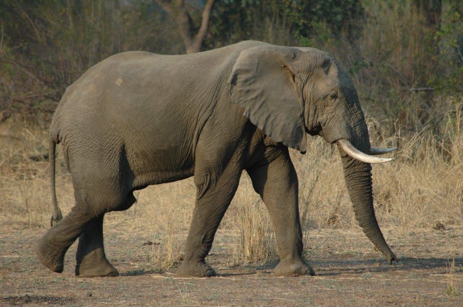
The current standard approach to tracking species for conservation purposes involves the use of aircraft surveys or catch and release projects. More recently though, researchers from Oxford University and the University of Bath collaborated to develop a novel technique involving the use of AI and satellite imaging. This has been trialled on African elephant populations in South Africa’s Addo Elephant National Park, where populations are rapidly declining to an estimated remainder of 40,000 left, primarily driven by poaching and habitat loss.
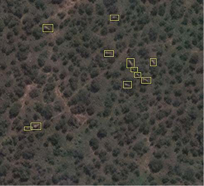
Using this technology, up to 5,000 square kilometres of elephant habitat can be captured in a single day using a satellite orbit 372 miles in space. This is not only efficient but has significant benefits for conservation, as it reduces the risk of double counting, and previously inaccessible places can now be studied. Furthermore, cross-border areas can be surveyed, which is crucial for large-scale conservation plans.
Up to 5,000 square kilometres of elephant habitat can be captured in a single day using a satellite
Satellite imaging for counting animal populations is not completely new as they have been used to track whales in the ocean, but the capacity to do this across complex heterogeneous landscapes is a new advancement. These captured images are then processed using an algorithm created by Dr Olga Isupova, through machine learning. The machines are trained to automatically distinguish elephants from other landscape features.
Although conservationists interested in using this must pay for access to satellites, this technology opens the door for rapid large-scale data collection that can provide invaluable information towards effective conservation approaches. It is currently being improved through better image resolutions, and trails to detect smaller species such as the black albatross, which is one-eleventh the size of an elephant.